Drone Photogrammetry – Learning the Process from the Ground Up

Solo Project – Spring 2024
Summary: Built a full photogrammetry workflow using a consumer drone and open-source processing software.
Software: WebODM
Equipment: DJI Air 2, survey-grade ground control points (GCPs)
Methods: Manual flight planning, GCP placement, orthomosaic and DSM generation
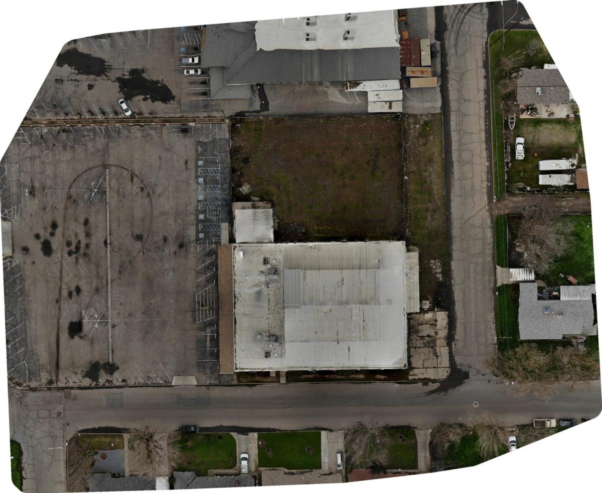
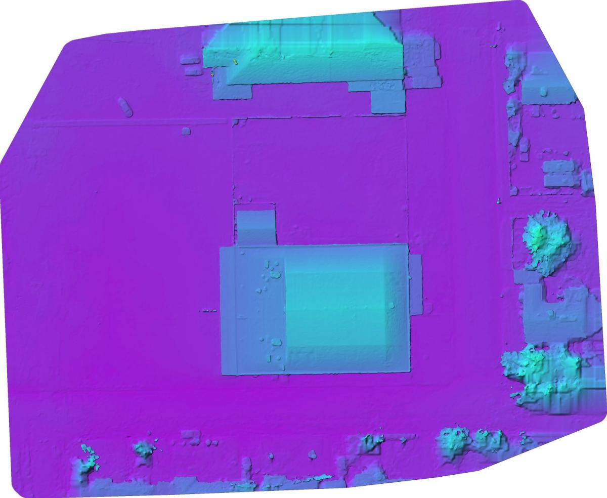
Outcomes: Processed 89 high-res images with a ground resolution of 1.3 cm. Identified distortion due to limited GCP coverage, reinforcing the importance of edge control in photogrammetric workflows.
Project Overview: This was a self-guided project to build a complete photogrammetry workflow using a consumer drone. I planned and executed a flight with the DJI Air 2, manually placed and surveyed ground control points, and processed imagery into an orthomosaic and digital surface model using WebODM.
Despite using entry-level tools and having no formal instruction at the time, I achieved a 1.3 cm ground resolution. The project helped me understand core photogrammetric principles—especially how flight planning and control coverage directly impact accuracy.
Key Skills Gained:
- Workflow design and field-to-finish execution
- GCP placement and georeferencing
- Aerial survey planning (overlap, altitude)
- Imagery processing in WebODM (orthomosaic, DSM)
- Troubleshooting common issues like edge distortion
Published: 2025-05-01 11:03:00