My Final Subdivision Map
Published: 2025-05-04 22:35:00
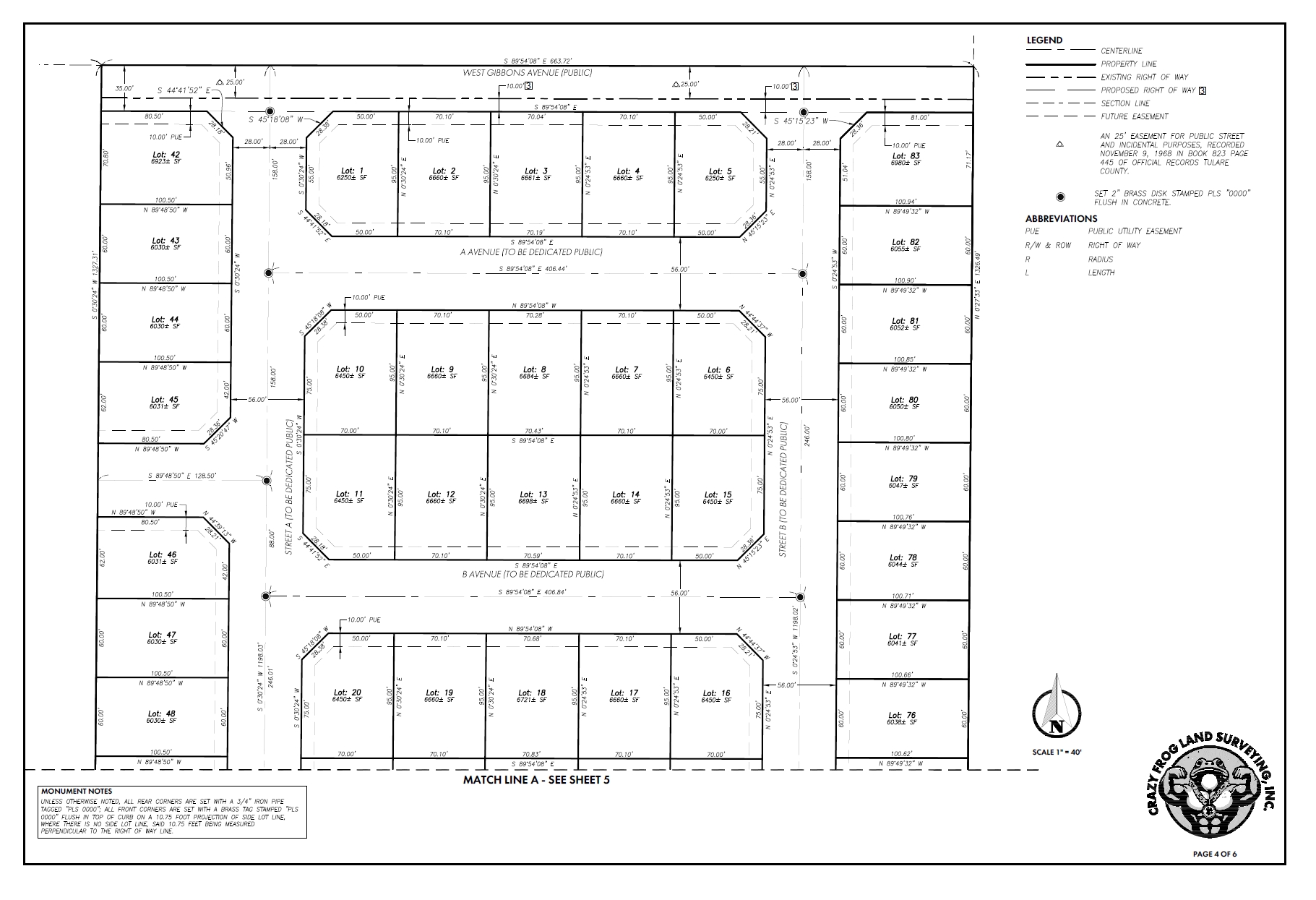
This was my final for the subdivision design course.
Read More
Undergraduate Geomatic Engineering Student at California State University, Fresno.
This portfolio includes work from coursework, personal experiments, industry projects, and research. Each entry highlights tools used, methods applied, and lessons learned—with a focus on practical problem-solving and improving productivity, including work with GNSS, CAD automation, photogrammetry, and GIS.
This was my final for the subdivision design course.
Read More
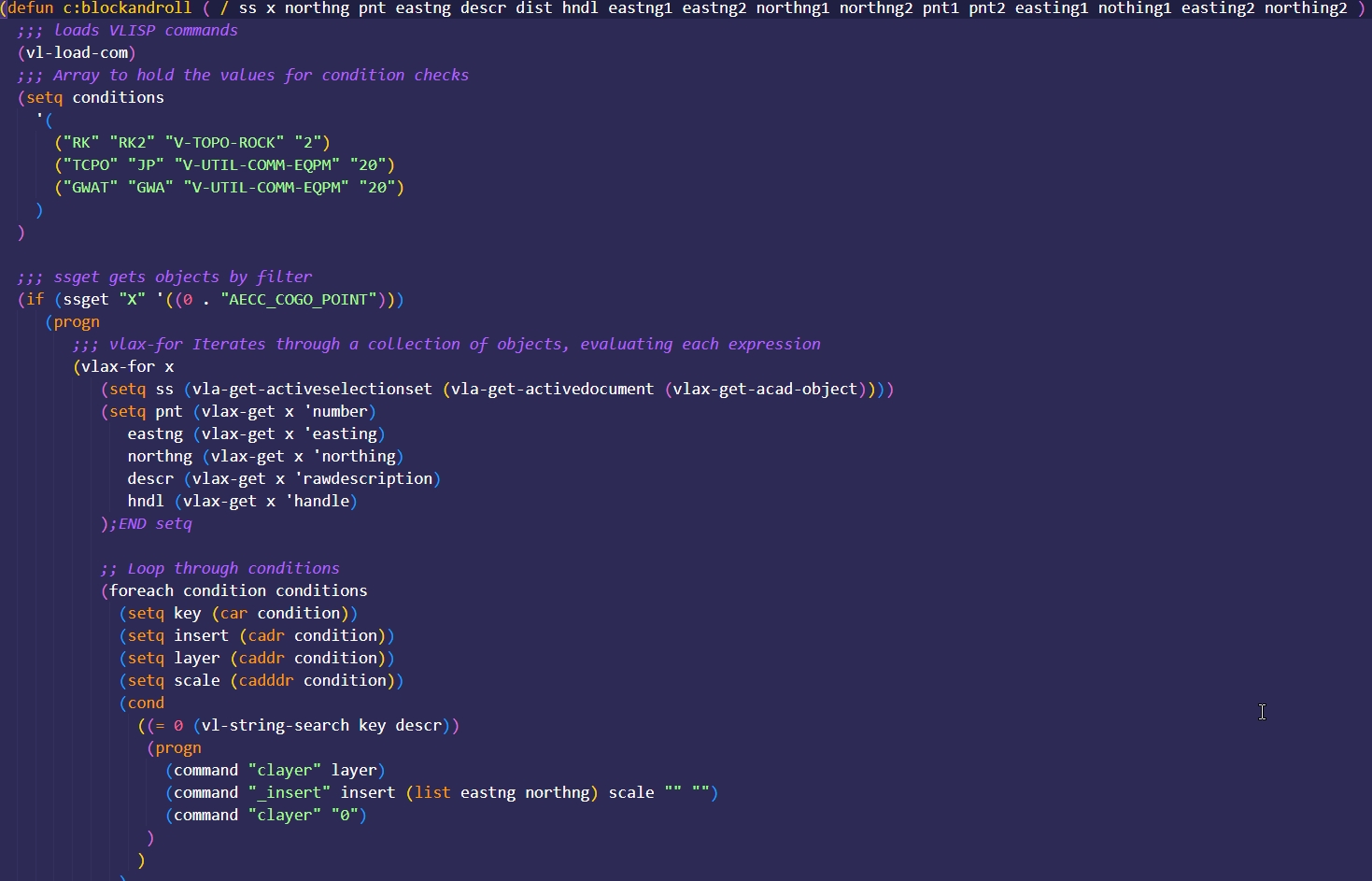
Over winter break, I rewrote a personal AutoLISP tool called `Block-And-Roll.lsp`, which automates CAD block placement in Civil 3D based on point descri...
Read More
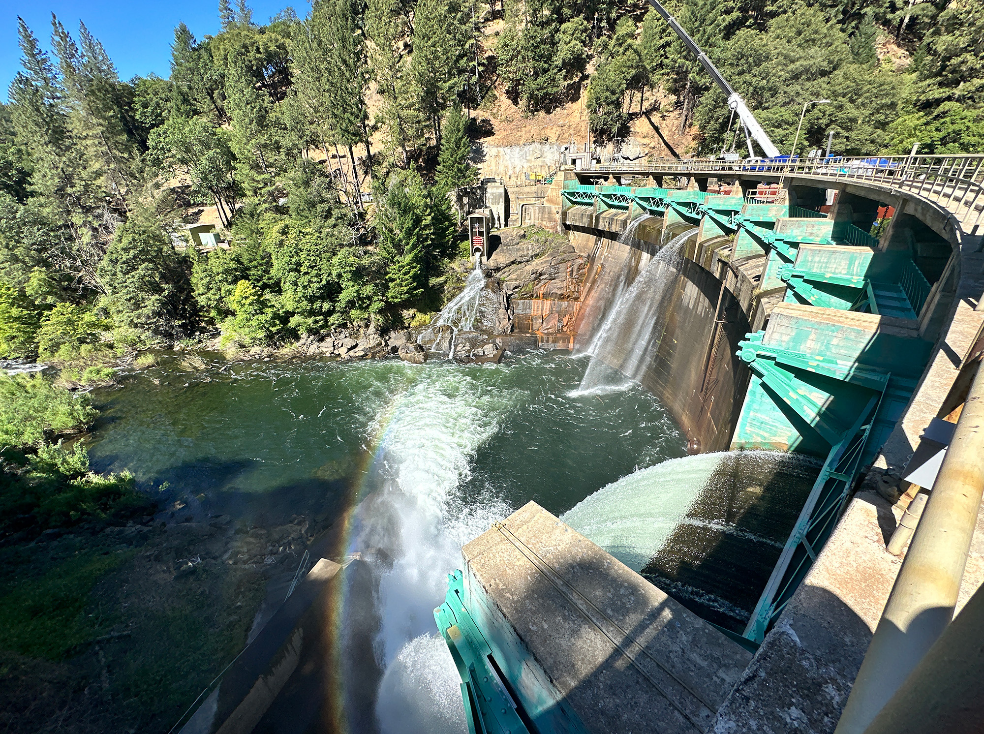
Assisted with automated monitoring of emergency spillway construction using Trimble 4D Control and automated total stations. Maintained server infrastructure, added monitoring points, and delivered weekly displacement reports to the...
Read More
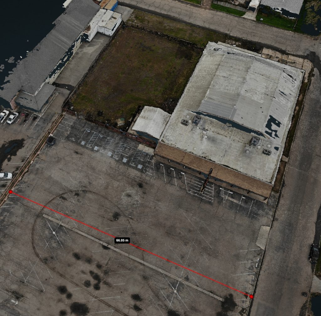
Built a full photogrammetry workflow using a consumer drone and open-source processing software.
Read More
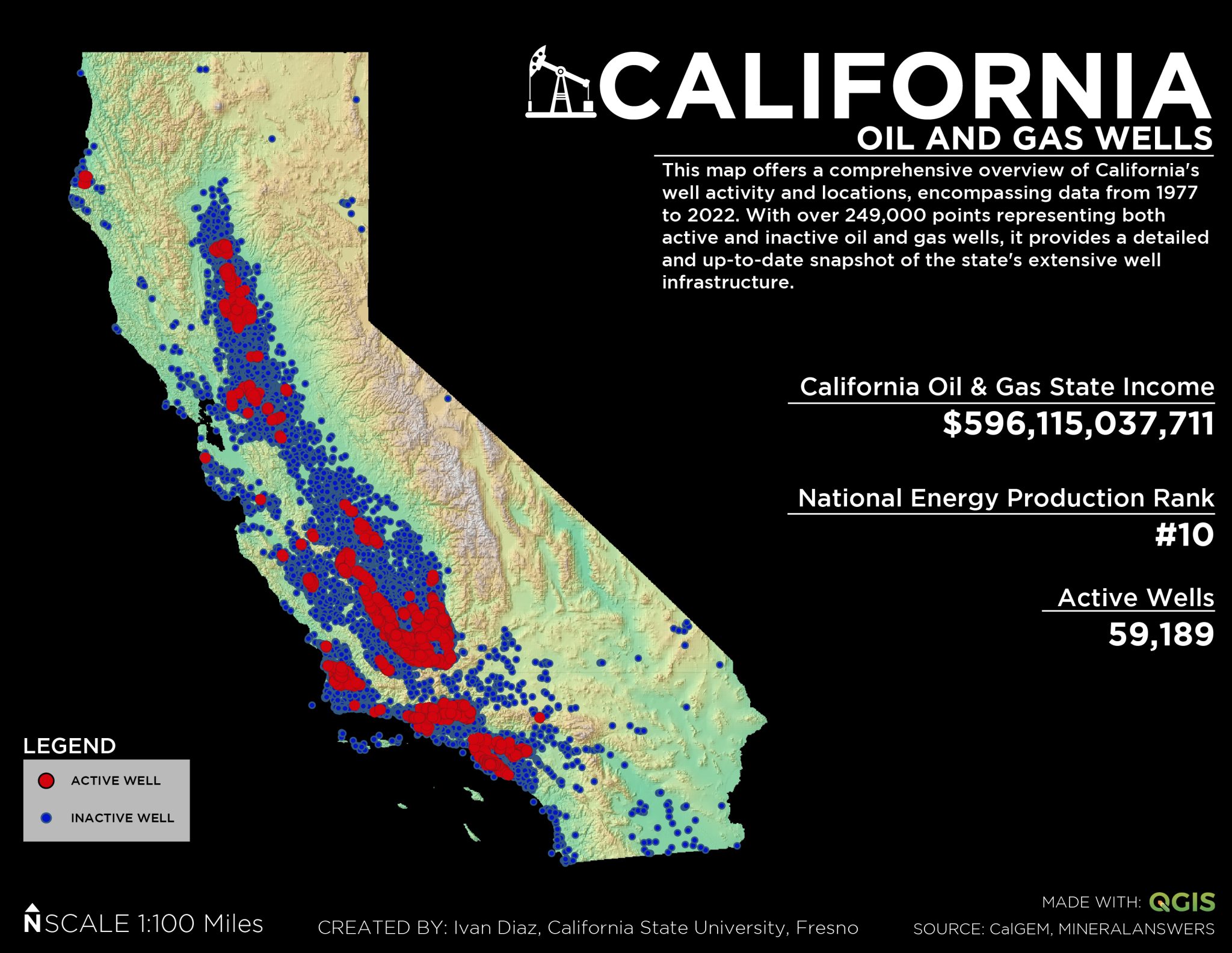
Mapped over 249,000 oil and gas wells across California (1977–2022) using public data and QGIS. The project gave me early, hands-on experience with large geospatial datasets before taking a formal GIS course.
Read More